
Last updated: 7 October 2026
The old version of this post talked about the Malir Expressway the way Karachi talked about it for years: as a project. A plan. Something that would be finished in "three to five years," a deadline that kept sliding. That version is now history. On 22 May 2026, Bilawal Bhutto Zardari formally inaugurated the completed 39-kilometre expressway, officially named Shahrah-e-Bhutto, and Karachi finally got the river-corridor road it had been promised since 2020. Everything below reflects the road as it stands in October 2026: open, tolled, and already reshaping property values on the M-9 belt.
If you are reading this from the Gulf, wondering whether that plot in Bahria Town Karachi or DHA City you have been sitting on is finally worth something more than patience, this is the infrastructure story that changes the maths. Let me walk through what the road is, what it costs to use, and the honest version of what it does and does not do for property prices.
The Headline: Inaugurated 22 May 2026
After years of phased openings and missed deadlines, the full expressway was inaugurated on 22 May 2026. The road is formally Shahrah-e-Shaheed Zulfikar Ali Bhutto, shortened to Shahrah-e-Bhutto in most reporting, but everyone in Karachi still calls it the Malir Expressway. Same road, two names. If you see either one on a map or in a news report, you are looking at the same 39 kilometres of asphalt along the Malir River.
The opening had been expected for months. Back in May 2026, senior Sindh minister Sharjeel Inam Memon announced the corridor would be fully opened to public traffic by the end of that month, noting the project had crossed 88 percent completion earlier in the year. The inauguration followed, and the remaining finishing works continued into the summer. By October, the expressway is an operating road, not a construction site.
One thing worth saying plainly, because Karachi has heard big promises before: the road arrived roughly six years after its December 2020 foundation stone, with delays from funding trouble, floods and redesigns along the way. The Asian Development Bank withdrew its funding at one point, which is part of why the timeline stretched. The road exists now, and that is what matters for commuters and investors. But the history is a useful reminder that when someone tells you a Karachi infrastructure project will finish "in two years," you should smile politely and check back in five.
The Route, in Plain Terms
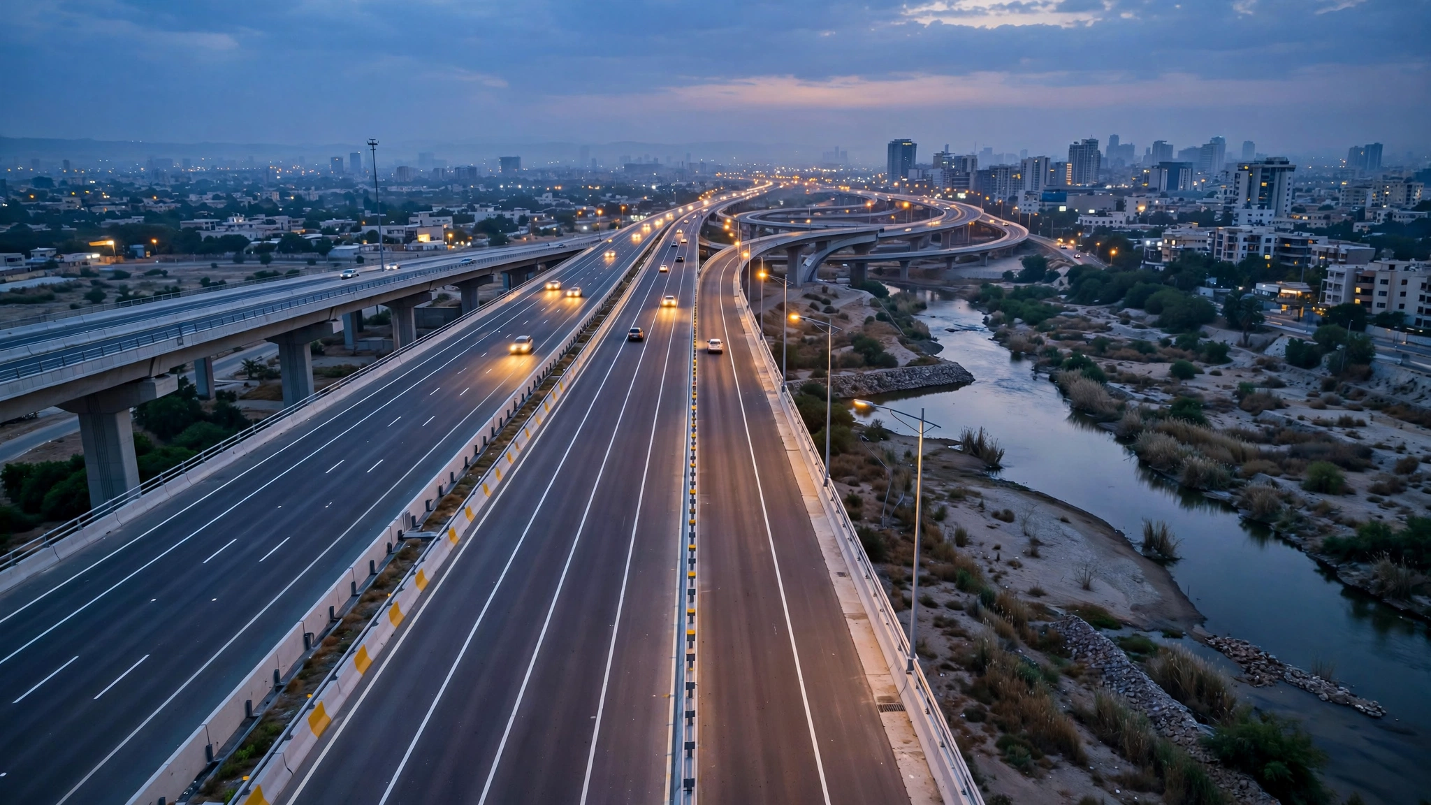
The expressway runs from the KPT Interchange near Qayyumabad, starting at Korangi Creek Avenue on the DHA side, and travels along the Malir River corridor all the way to Kathore, where it meets the M-9 Karachi–Hyderabad Motorway, the Superhighway. Total length is about 39 kilometres, commonly cited as 39.4 km in project documents.
It is a six-lane, access-controlled dual carriageway, three lanes each way, built for a design speed of 100 km per hour, with interchange areas designed for 50. The project includes a roughly 5-kilometre elevated section, three flyovers and eight underpasses, plus a three-lane service road on each side. Interchanges along the corridor include Qayyumabad, Quaidabad, Memon Goth, Malir Halt, Landhi, Korangi and Kathore, with the Quaidabad and Jam Sadiq interchanges among the structures that took the longest to finish.
The first stretch to open was a 9.1-kilometre section from Korangi Causeway to Shah Faisal, inaugurated on 11 January 2025 by Bilawal Bhutto Zardari, with a connecting flyover from Korangi and a ramp to get traffic flowing immediately. That phase proved the concept. The rest of the corridor, including the critical Kathore interchange linking to the M-9, followed through 2025 and into 2026.
Geography is the whole point of this road. Karachi's growth has been pushing northeast along the Superhighway for a decade, but the city and the M-9 belt were connected by slow, signal-choked routes. This expressway is the bypass that side of Karachi never had. It runs through or past Shah Faisal, the airport zone, Malir Cantt, Quaidabad and Landhi, and drops you at Kathore, which is the doorstep of DHA City Karachi, Bahria Town Karachi and the whole suburban investment belt.
Toll Rates and Road Rules
Yes, it is a toll road. The expressway was built as a public-private partnership on a design-build-finance-operate-and-transfer basis, with a 28-year concession, so the toll is how the operator gets paid. It is also the largest PPP project in Sindh after the Thar Coal project, which tells you something about the scale of money involved. The final project cost was reported at Rs 54.7 billion in May 2026, roughly double the Rs 27 billion-plus figure quoted when construction began.
The toll rates announced at the Phase-I opening were Rs 100 for cars and jeeps and Rs 200 for buses and heavy vehicles, collected through an automatic toll system with 18 booths along the corridor. Motorcycles and rickshaws are strictly prohibited on the expressway. That toll level has been a point of public discussion, and rates can be revised, so check the current toll before you build a daily commute around it. A hundred rupees each way is real money for a daily commuter, and it is part of the honest cost-benefit maths below.
On operations: traffic police patrols, fire brigades and Rescue 1122 ambulances were assigned to the corridor at opening, and the Shah Faisal Interchange to Shah Faisal Colony bridge stretch was declared a no-parking zone. These are the small details that separate a road that works from one that just exists.
The Commute Numbers That Actually Matter
Here is why Karachi cares. Before this road, getting from the DHA and Korangi side out to DHA City, Bahria Town Karachi or the M-9 meant 60 to 90 minutes in peak traffic through Shahrah-e-Faisal or the Lyari Expressway route, with signals, congestion and the general exhaustion that defines Karachi commuting. On the expressway, that same journey drops to roughly 25 to 30 minutes. The Sindh government has claimed commuters can save up to an hour per trip, and one official briefing put the Jam Sadiq Bridge to Jinnah Terminal run at just 15 minutes.
Do the arithmetic the way a commuter would. Saving even 45 minutes each way is 90 minutes a day, which is more than 30 hours a month handed back to your life. For families, that is the difference between seeing your kids before bedtime and not. For businesses moving goods between the port and the industrial zones, it is fuel, driver hours and delivery reliability.
There is a flip side, and I will not skip it. The time saving is real only if the toll booths flow, the interchanges near your start and end points are the finished ones, and you are not entering at a chokepoint during rush hour. Early users reported the expected teething issues. A new road also attracts new traffic, which eats into the time saving over the years. None of that cancels the benefit. It just means the 25-minute figure is the good-day number, and you should plan around the average day.
What It Does to Property Values Along the M-9 Belt
Roads move property prices in Karachi more reliably than almost anything else, and this one lands on the corridor where the city's biggest suburban bets are placed. The areas that gain most are the ones the expressway suddenly makes reachable: DHA City Karachi, Bahria Town Karachi, Malir Cantt, the airport zone, and the projects sitting right along the route, including ARY Laguna at DHA City.
The logic is simple. For years the single biggest knock on Bahria Town Karachi was distance from the established city. That argument is now much weaker. A 25 to 30-minute signal-free run from Korangi to the M-9 belt changes who can realistically live in Bahria Town while working in DHA or Clifton. When commute time collapses, the price gap between the connected suburb and the established city starts to close, and it usually closes by the suburb rising.
DHA City Karachi benefits the same way, and arguably more directly, since the Kathore interchange feeds straight into it. Our ARY Laguna balloting guide for DHA City Karachi covers what is happening inside that specific project, and our Bahria Town Karachi price tracker follows the daily rates if you want to watch the corridor premium develop in real time.
Now the honest part, because this is where investors lose money. Some of this upside is already priced in. Dealer boards and property portals spent 2024 and 2025 marketing "expressway-adjacent" plots, which means the inauguration premium was partly captured before the ribbon was cut. Buying after a road opens, at prices that assume the road's full benefit, is how you pay for someone else's foresight. The investors who did well here bought during the delay years, when the road was a rumour and the prices reflected doubt.
That does not mean the story is over. Infrastructure premiums in Karachi tend to arrive in two waves: the announcement wave, which this road has had, and the occupancy wave, which comes when families actually move in and commercial activity follows the traffic. The second wave is slower and harder to time, but it is usually the bigger one. If you are buying on the corridor now, buy on current rental yields and genuine end-user demand, not on a forecast that prices will double in 18 months. Anyone promising you that is selling you something.
The Catches Worth Knowing
Every honest write-up of this road should include the complications, because they affect both commuters and investors.
First, the road runs along the Malir River, and rivers flood. The project's history includes flood-related delays, and recent construction reports specifically mentioned dedicated water passages being built at the Kathore interchange to prevent future flood damage. The corridor is engineered for it, but a river-adjacent expressway in a city with Karachi's drainage record deserves a watchful eye during monsoon season.
Second, the toll economics. A PPP road with a 28-year concession and a minimum revenue guarantee from the government needs traffic to pay for itself. If tolls rise faster than incomes, usage softens, and the road benefits fewer people than the ribbon-cutting suggested. Watch the toll revisions the way you would watch any other cost of living in Karachi.
Third, finishing works. The inauguration marked the road as open, but large projects like this keep working on interchanges, service roads and landscaping for months afterwards. If your daily route depends on a specific interchange, confirm it is the finished one before you commit to the commute.
Fourth, the name confusion is real and will waste your time if you let it. Malir Expressway, Shahrah-e-Bhutto, Shahrah-e-Shaheed Zulfikar Ali Bhutto: one road. When a dealer tells you a plot is "near Shahrah-e-Bhutto," ask which interchange. "Near the expressway" can mean a two-minute drive or a twenty-minute one, and the price should know the difference.
What I Would Tell an Overseas Karachiite
A lot of Saiban Associates' Karachi-origin clients live in the Gulf and hold property on the M-9 belt that they bought years ago on a promise. If that is you, the expressway changes your holding from a waiting game into a timing question. The road is open, the commute works, and end-user demand on the corridor is now built on something real rather than a brochure render.
That is not the same as saying you should rush to buy more. Ask yourself three questions. One, is your plot in a block where construction and possession are actually moving, or is it in a file-stage sector where the road is the only good news? Two, are current asking prices already assuming five years of corridor growth? Three, if you are choosing between putting fresh money into Karachi or into Dubai, have you compared honestly? Our Dubai timing guide and the National Housing Policy 2026 give you both sides of that decision, and our overseas buying guide covers the NICOP and power-of-attorney paperwork for buying in Pakistan from abroad.
My own view: the expressway is the best thing to happen to Karachi's suburban property market in a decade, and the investors who benefit most will be the ones who buy specific, verifiable plots near finished interchanges and hold them while the occupancy wave builds. Vague proximity to a famous road is not an investment thesis. A plot number near a working interchange, in a block with construction activity, is.
If you want a second pair of eyes on a specific plot or project along the corridor, that is exactly what the Saiban Associates team does. We will tell you which interchange actually serves the block you are looking at, what the current asking rates are, and whether the premium you are being quoted has already eaten the road's upside. Message us on WhatsApp.